Emergency Management News

Wednesday, June 29, 2016

July Climate Data from @OKmesonet for #AltusOK

Shown as July 2016
SundayMondayTuesdayWednesdayThursdayFridaySaturday
Periods of Record
Temps#1903-2010
Precip#1903-2012
Snow#1903-2012
# - large gaps in record
Key
* - Record since tied
Highlight = Jul record
All Temps in deg F
All Precip in inches
Sig Prcp Freq = Pct of
days with >= 0.1" precip
Jul. Averages
High Temp98 F
Low Temp71 F
Avg Temp84 F
Precip2.05"
Snow0.0"
  
1T Avgs: 95/69
Sig Prcp Freq: 15%
Extremes:
High T110 (1980)
Low T56 (1922)
Precip1.21 (1953)
2T Avgs: 95/69
Sig Prcp Freq: 14%
Extremes:
High T111 (1980)
Low T58 (1924)
Precip1.10 (1968)
3T Avgs: 96/70
Sig Prcp Freq: 10%
Extremes:
High T112 (1980)
Low T59 (1924)
Precip0.87 (2010)
4T Avgs: 96/69
Sig Prcp Freq: 10%
Extremes:
High T111 (1980)
Low T59* (1922)
Precip1.48 (1950)
5T Avgs: 96/69
Sig Prcp Freq: 8%
Extremes:
High T110 (1947)
Low T56 (1915)
Precip1.45 (1950)
6T Avgs: 96/69
Sig Prcp Freq: 11%
Extremes:
High T110 (1996)
Low T56 (1931)
Precip2.05 (1920)
7T Avgs: 97/70
Sig Prcp Freq: 11%
Extremes:
High T110 (1998)
Low T60 (2004)
Precip3.67 (1914)
8T Avgs: 97/70
Sig Prcp Freq: 8%
Extremes:
High T107 (1925)
Low T56 (1952)
Precip2.40 (1928)
9T Avgs: 98/71
Sig Prcp Freq: 10%
Extremes:
High T110 (1917)
Low T57 (1952)
Precip2.08 (1996)
10T Avgs: 97/71
Sig Prcp Freq: 9%
Extremes:
High T109 (2009)
Low T59 (1952)
Precip1.60 (1996)
11T Avgs: 98/71
Sig Prcp Freq: 12%
Extremes:
High T111 (1933)
Low T60 (1999)
Precip1.51 (1996)
12T Avgs: 97/71
Sig Prcp Freq: 16%
Extremes:
High T110 (1954)
Low T60 (1975)
Precip1.68 (1944)
13T Avgs: 97/70
Sig Prcp Freq: 6%
Extremes:
High T109* (1923)
Low T58 (1990)
Precip1.05 (1927)
14T Avgs: 97/70
Sig Prcp Freq: 12%
Extremes:
High T110 (1936)
Low T55 (1990)
Precip0.99 (1996)
15T Avgs: 98/71
Sig Prcp Freq: 7%
Extremes:
High T110 (1936)
Low T60 (1987)
Precip2.02 (1968)
16T Avgs: 97/71
Sig Prcp Freq: 9%
Extremes:
High T110 (2001)
Low T61 (1959)
Precip0.70 (1992)
17T Avgs: 98/71
Sig Prcp Freq: 9%
Extremes:
High T111 (1989)
Low T61 (1919)
Precip1.72 (1919)
18T Avgs: 98/71
Sig Prcp Freq: 10%
Extremes:
High T110 (1936)
Low T63 (1930)
Precip0.88 (1979)
19T Avgs: 97/70
Sig Prcp Freq: 19%
Extremes:
High T120 (1936)
Low T61 (1928)
Precip2.04 (1967)
20T Avgs: 98/70
Sig Prcp Freq: 11%
Extremes:
High T110 (1936)
Low T62 (1947)
Precip1.37 (1950)
21T Avgs: 97/70
Sig Prcp Freq: 11%
Extremes:
High T110 (1981)
Low T54 (1915)
Precip2.25 (1915)
22T Avgs: 97/70
Sig Prcp Freq: 10%
Extremes:
High T110 (1981)
Low T56 (1970)
Precip1.90 (1926)
23T Avgs: 97/70
Sig Prcp Freq: 9%
Extremes:
High T110 (1943)
Low T54 (1970)
Precip0.80 (1971)
24T Avgs: 97/70
Sig Prcp Freq: 14%
Extremes:
High T110 (1943)
Low T62* (1915)
Precip3.18 (1995)
25T Avgs: 97/70
Sig Prcp Freq: 15%
Extremes:
High T112 (1954)
Low T60 (1927)
Precip2.11 (1975)
26T Avgs: 97/71
Sig Prcp Freq: 5%
Extremes:
High T110 (1963)
Low T59 (2004)
Precip1.68 (1975)
27T Avgs: 97/70
Sig Prcp Freq: 9%
Extremes:
High T108* (1964)
Low T60 (1994)
Precip0.61 (1950)
28T Avgs: 98/71
Sig Prcp Freq: 8%
Extremes:
High T109* (1936)
Low T56 (2005)
Precip0.60 (1991)
29T Avgs: 98/71
Sig Prcp Freq: 13%
Extremes:
High T109 (2008)
Low T58 (2005)
Precip0.96 (2002)
30T Avgs: 97/70
Sig Prcp Freq: 15%
Extremes:
High T110 (1947)
Low T58* (1965)
Precip2.70 (1925)
31T Avgs: 97/70
Sig Prcp Freq: 5%
Extremes:
High T109 (1914)
Low T57 (1925)
Precip1.36 (1979)

Saturday, June 25, 2016

Ethanol Training available #OKfire #AltusOK

RFA and TRANSCAER®  are hosting two webinar training opportunities titled “Train the Trainer” to members and their emergency response teams. Professional hazmat trainer Richard Miller of the International Association of Fire Chiefs will teach individuals how to train others in ethanol emergency response tactics and procedures. These webinars will take place Thursday, July 14, 2016 and August 31, 2016 from 1 p.m. to 3 p.m. CDT via WebEx and will be FREE to attend.

“Train the Trainer” is a pay-it-forward type of program. A single webinar can train a group of individuals who can then turn around and pass that information forward, equipping entire communities with the knowledge necessary to respond to any potential ethanol-related emergency. The webinar is open to all individuals interested in learning how to teach ethanol emergency response, but will be tailored toward ethanol production facility employees, ethanol safety professionals, railroad safety professionals, emergency responders, firefighters, police officers, emergency management professionals, etc.

We know that ethanol plant managers are always looking for worth-while training events for their emergency response teams and RFA’s “Train the Trainer” program offers a unique look at how to clearly convey emergency response tactics to others. For those unable to attend the previous “Train the Trainer” seminars / webinars, this is your chance to tune in and learn without having to leave your desk.

We highly encourage all RFA members to sign up and join the webinar. Registration is required. Individuals interested in registering for the webinar can visit www.rfa.trainscaster.com.

*EVERYONE MUST REGISTER AT www.rfa.traincaster.com . IF YOU HAVE NOT BEEN TO THE SITE BEFORE, CLICK ON THE REGISTER BUTTON WHICH IS LOCATED UNDER THE LOGIN.  IF YOU HAVE BEEN ON THE SITE BEFORE, LOG IN WITH YOUR USER NAME AND PASSWORD.
  • ONCE LOGGED IN, CLICK ON THE “TRAIN THE TRAINER: ETHANOL EMERGENCY RESPONSE SEMINAR” LINK.
  • NEXT CLICK ON THE BLUE “CLASSROOM TRAINING” BUTTON.
  • THEN CLICK THE “REQUEST APPROVAL” BUTTON.
*CLASS IS LIMITED TO THE FIRST 100 ATTENDEES. IF YOU DO NOT FOLLOW THE ABOVE STEPS YOU WILL NOT BE PLACED IN THE CLASS*

Wednesday, June 22, 2016

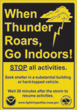
When Thunder Roars, come indoors #OKwx #Skywarn #AltusOK

Lightning Safety

When Thunders Roars logo

According to the National Weather Service (NWS),lightning strikes the United States about 25 million times each year. While lightning mostly occurs during the summer months, it can happen at any time of the year.
Talk with your family about staying safe during thunderstorms. Here are just a few lightning safety tipsthat the NWS offers if you are indoors:
  • Stay off corded phones. You can use cellular or cordless phones;
  • Don’t touch electrical equipment such as computers, TVs, or cords. You can use the remote control safely; and
  • Stay away from windows and doors that might have small leaks around the sides to let in lightning, and stay off porches.
According to the NWS, if you are outside during a storm it is important toget inside a safe building or vehicle. You are NOT safe outdoors, but if you absolutely cannot get to safety, follow these tips to slightly lessen the threat of being struck by lightning:
  • Avoid open fields, the top of a hill, or a ridge top;
  • Stay away from tall, isolated trees or other tall objects. If you’re in a forest, stay near a lower stand of trees; and
  • If you’re in a group, spread out to avoid the current traveling between group members.

Saturday, June 18, 2016

#OKfire Webinar June 23

Ember Alert: Preparing for Wildfires

Are you prepared for a wildfire? To kick off the summer, FEMA’s Individual and Community Preparedness Division invites you to a webinar onThursday, June 23, 2016. This webinar will feature an array of dynamic nationwide programs and resources to prepare individuals and communities for wildfires.
Date: Thursday, June 23, 2016
Time: 2:00 – 3:00 p.m. EDT
Featured Speakers:                                 
  • Phyllis Krietz, United States Fire Administration, FEMA
  • Barbara Geringer, Fire Prevention, Mitigation, and Education Program Manager, United States Forest Service
  • Mark Jackson, Branch of Wildland Fire Management, Bureau of Indian Affairs
  • Cathy Prudhomme, National Fire Protection Association
  • Christi Collins, Individual and Community Preparedness Division, FEMA
How to Join the Webinar:
 We hope that you will be able to join us on June 23!

Wednesday, June 15, 2016

Beat the Heat! #AltusOK #OKwx

"It's hot," said Wayne Cain, Jackson County Emergency
Manager, "and area residents need to use caution working outside."

He offered tips of:

* drink lots of fluid (avoiding caffeine and alcohol)
* take frequent breaks
* wear sun screen and hats to offset the extreme Ultra-Violet Radiation index

Lloyd Colston, Altus Emergency Manager, also encouraged neighbors to
be neighborly.  "If you have a neighbor who just got home from the
hospital, please make sure they have a way to stay cool."

This advice also is for those with pets, young children, or the elderly.

Colston stated the UV index has been extreme over the last few days.

Cain encouraged area residents to know the signs of heat stroke,
heat exhaustion, and heat stress.  He also encouraged residents to
"Use a buddy system when working in excessive heat."  The American Red
Cross first aid information is at http://www.redcross.org/prepare/disaster/heat-wave

National Weather Service information for heat issues is at
http://www.weather.gov/om/heat/index.shtml, information about UV index
is at http://www.epa.gov/sunwise/uviscale.html while the Federal
Emergency Management Agency has tips at
https://www.ready.gov/heat

HEAT ADVISORY NOW IN EFFECT UNTIL 8 PM CDT FRIDAY...16-17 June ... does NOT include 
City of Altus but it will be close since Kiowa and Tillman County is included.

* TEMPERATURE...HEAT INDICES ARE EXPECTED RISE INTO THE 105 TO 110
  DEGREE RANGE THURSDAY AND FRIDAY.

* IMPACTS...A HEAT ADVISORY MEANS THAT A PERIOD OF HOT 
  TEMPERATURES IS EXPECTED. THE COMBINATION OF HOT TEMPERATURES 
  AND HIGH HUMIDITY WILL COMBINE TO CREATE A SITUATION IN WHICH 
  HEAT ILLNESSES ARE POSSIBLE. 

PRECAUTIONARY/PREPAREDNESS ACTIONS...

TAKE EXTRA PRECAUTIONS IF YOU WORK OR SPEND TIME OUTSIDE. WHEN
POSSIBLE...RESCHEDULE STRENUOUS ACTIVITIES TO EARLY MORNING OR
EVENING. KNOW THE SIGNS AND SYMPTOMS OF HEAT EXHAUSTION AND HEAT
STROKE. WEAR LIGHTWEIGHT AND LOOSE FITTING CLOTHING WHEN POSSIBLE
AND DRINK PLENTY OF WATER.


Can you offer some additional tips for staying safe in this period of hot weather?

Saturday, June 11, 2016

Roadmap to Resilience Training #OKready


Over the course of the past year, FEMA’s Individual and Community Preparedness Division (ICPD) has been developing a new training course entitled, Building a Roadmap to Resilience: A Whole Community Training.  This course is designed to inspire and provide participants with information intended to increase a community’s resilience through the whole community approach to emergency management. On July 25-27, 2016, ICPD and the Emergency Management Institute will host the first delivery at the National Emergency Training Center in Emmitsburg, MD.
FEMA published A Whole Community Approach to Emergency Management: Principles, Themes, and Pathways for Action in December 2011. This report provides communities a foundation for developing a community-centric approach focusing on the strengths and capabilities of the community team to better prepare for, protect against, respond to, recover from, and mitigate against all hazards. Building a Roadmap to Resilience is intended to build upon the findings of FEMA as well as best practices uncovered by local efforts and turn them into manageable actions that local government entities can implement.  Participants in this course will receive the tools and knowledge to establish a community coalition and to encourage community leaders to make resiliency gains within the unique circumstances of their jurisdiction.
The target audience for this course includes community stakeholders interested in disaster resilience, and emergency management professionals with less than three years of experience who support or implement inclusive emergency management, community disaster planning, preparedness activities, and community outreach partners at the state and local levels.
If you know of individuals who may be interested in attending this offering, please direct them to their State Training Officer (or point of contact) to submit a FEMA Form 119-25-1, General Admissions Application (attached). The deadline to register is June 20, 2016.
Once an individual is placed into the course, NETC Admissions will send an acceptance email with travel instructions. Seats for the course are on a first-come, first-served basis. Once you are accepted into the course, you will receive some additional information from course managers regarding the agenda and what (if any) materials you should bring with you.
Wednesday, June 8, 2016

What is in your Go-Kit? #AltusOK #OKready #OKstrong

Packing Food for Your Disaster Supply Kit

When putting together your emergency food supplies:
  • Store at least a three-day supply of non-perishable food.
  • Choose foods your family will eat.
  • Remember any special dietary needs.
  • Avoid foods that will make you thirsty.
  • Choose salt-free crackers, whole grain cereals and canned foods with high liquid content.
Disasters can take a toll on your mental, emotional, and physical health. It’s important to the extent possible to eat a healthy diet not only to cope with the stress from the disaster, but also maintain your strength. Some food items could include:
  • Protein or fruit bars;
  • Nuts;
  • Crackers;
  • Peanut butter; and
  • Dried fruit.
These types of foods are listed because they require minimal food preparation and no cooking.  
Following a disaster, there may be power outages that could last for several days. Stock canned foods, dry mixes and other staples that do not require refrigeration, cooking, water or special preparation. Be sure to include a manual can opener and eating utensils.
Check out the America’s PrepareAthon! website on how to assemble and update your emergency supplies, including food, medication, and other items. 

Wednesday, June 1, 2016

Do you have and #EFFAK? #AltusOK #OKready

Securing Your Financial Documents

Many Americans experience the challenge of rebuilding their lives after a disaster or other emergency. In these stressful circumstances, having access to personal financial, insurance, medical, and other records is crucial for starting the process of recovery quickly and efficiently.
Taking the time now to collect and secure these critical records will give you peace of mind. In the event of an emergency, it will also ensure that you have the documentation needed to start the recovery process without delay.
The Emergency Financial First Aid Kit (EFFAK) can help you financially prepare if a disaster or other emergency strikes your community. The EFFAK contains four important steps to financial preparedness:
  • Assemble your important documents and contacts;
  • Review your insurance policies and financial paperwork to be sure that they are still accurate and current;
  • Store paper and electronic copies of all files in safe locations; and
  • Revisit and update your EFFAK on a regular schedule. (Updates are especially important when certain changes in your life occur, like a change in marital status, birth of a child, and opening or closing accounts.)
April is Financial Literacy Month. This month is a great opportunity to review and update your EFFAK. You can find more financial preparedness resources online.